

We (me and Kaushal) were once again on the roads. After 40 hours of continuous bus ride, we reached Khalanga, headquarter of Darchula, with our butts sore, heads cranky, and legs swollen. Prem uncle met us later that day and helped us know about the route. His help would come very handy later on for us.
We stayed at Khalanga for a day to know more about the route. Even then, we could see smoke plumes from more than one forest from our hotel’s roof. Our trek started after that. Following the mighty Mahakali, we crossed Bangabagad, Shreebagar, Brahmadev to reach Huti. Bangabagad reminds you of the alleyways in Kathmandu. Cliffs had been battered down to make roads and every curves seemed to have a temple. We had lunch at Huti and took off once again. At 1 pm, ‘Thor’ began. Wind and thunder. The wind blew rain straight at us. It forced us to stop at Dhaulakot where we had tea at a local priest’s hotel. Late in the evening, we reached Sunsera.
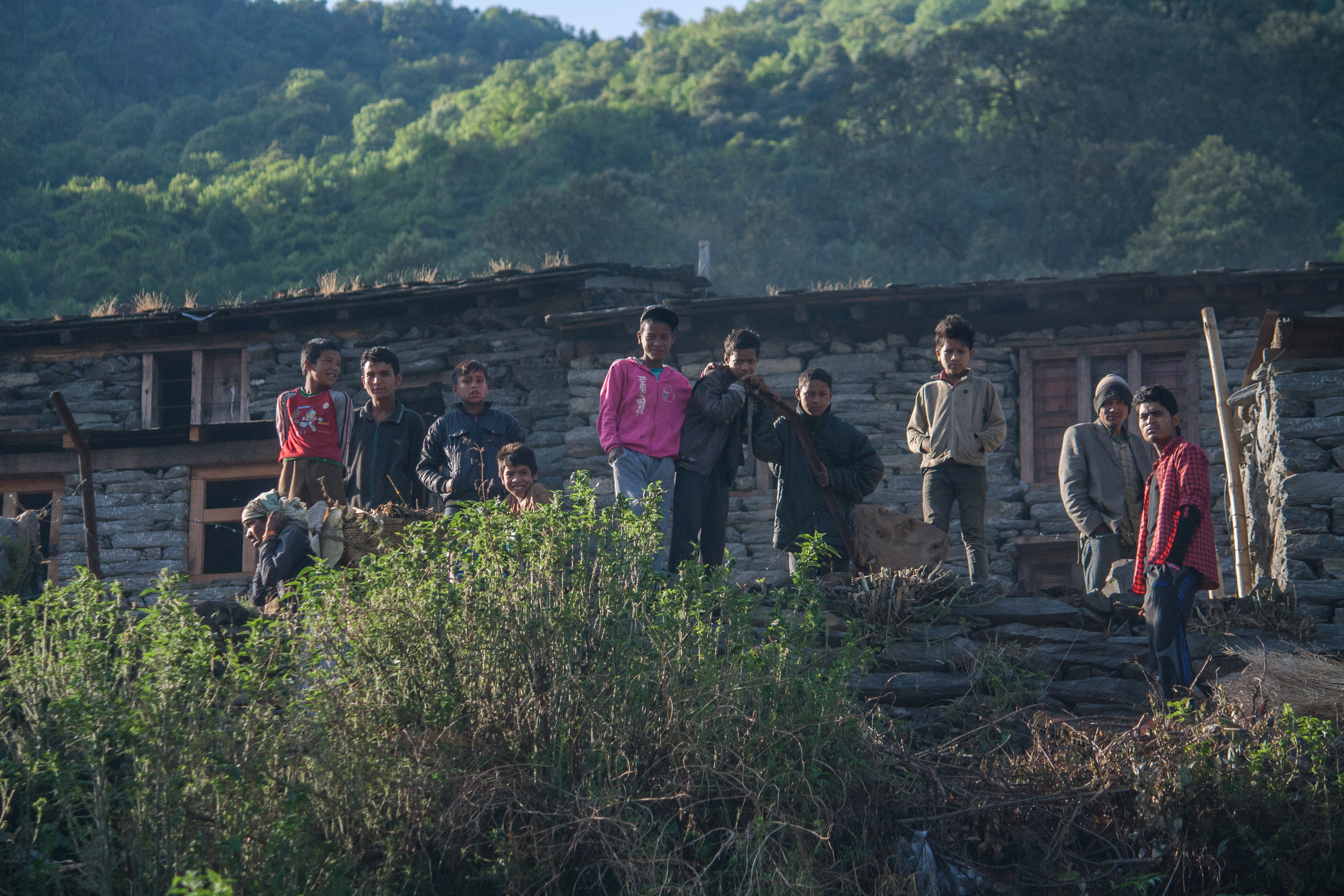
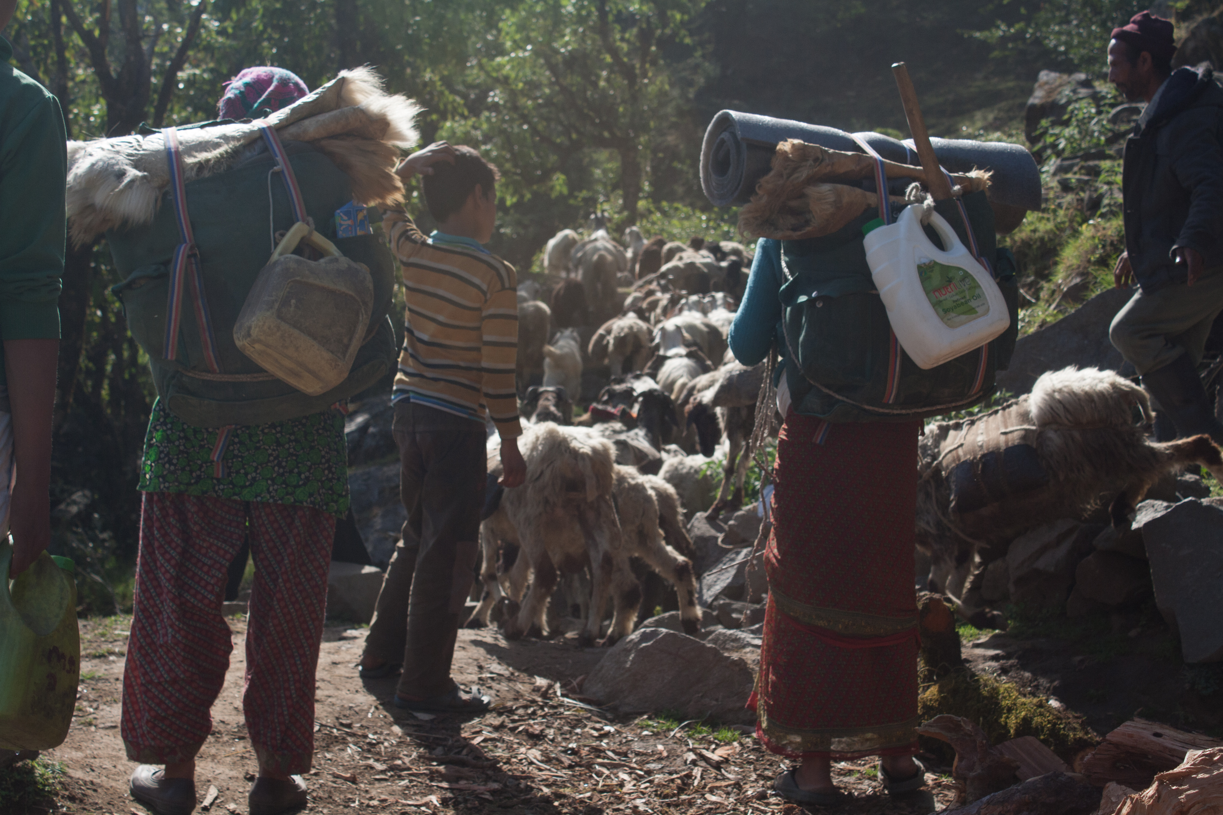
On our fifth day, April 23, we reached Dumling. Rain had opened up the sky and we could see the Indian side of Mahakali clearly. Migrating shepherds and their hundreds of sheep accompanied us. Sheep don’t walk in the midday heat and so the shepherds had to stop around noon at Maal Gaun. We passed through high cliffs around 200 m that would fall straight to Mahakali. Names of villages were kind of tough for me to pronounce and remember. Sagran, Fulechungan, Rangthala and Maal Gaun. Maybe. Rock folds could be seen clearly on our way. We reached Dumling around 5. Dumling is the entry point for Api-Nampa Conservation Area.
A magnificent waterfall greeted us right outside Dumling. The way took us right next to Mahakali where the trails were getting repaired. At the moment, it was an obstacle course. We came across Dudi Khola that was the highlight of our day. This river falls to Mahakali showing its full might. Water drops could reach us even when we were 20 m away. . We were greeted by 10-12 locals at Chattibagar who insisted on sharing their lunch with us. We declined politely and moved to Dopakhya. There were no other settlements in between. And it was all cliffs. The Indian side of trail has railings for safety. I enjoyed unobstructed view while emptying my bowels that had gone berserk from last night’s meal. At 3, we reached Dopakhya. We were lucky. The owners of Bhandari Hotel had arrived only the day before.
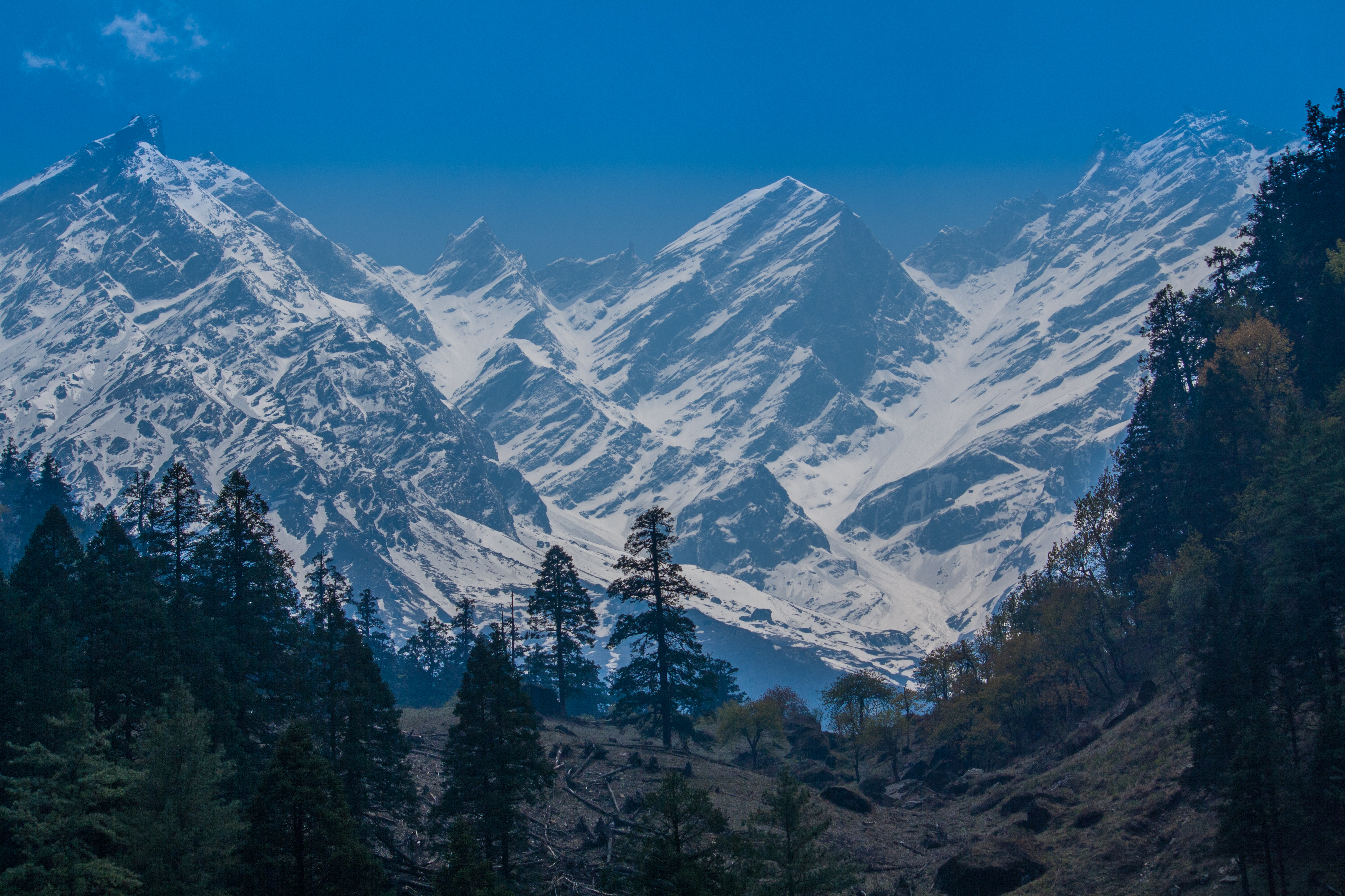
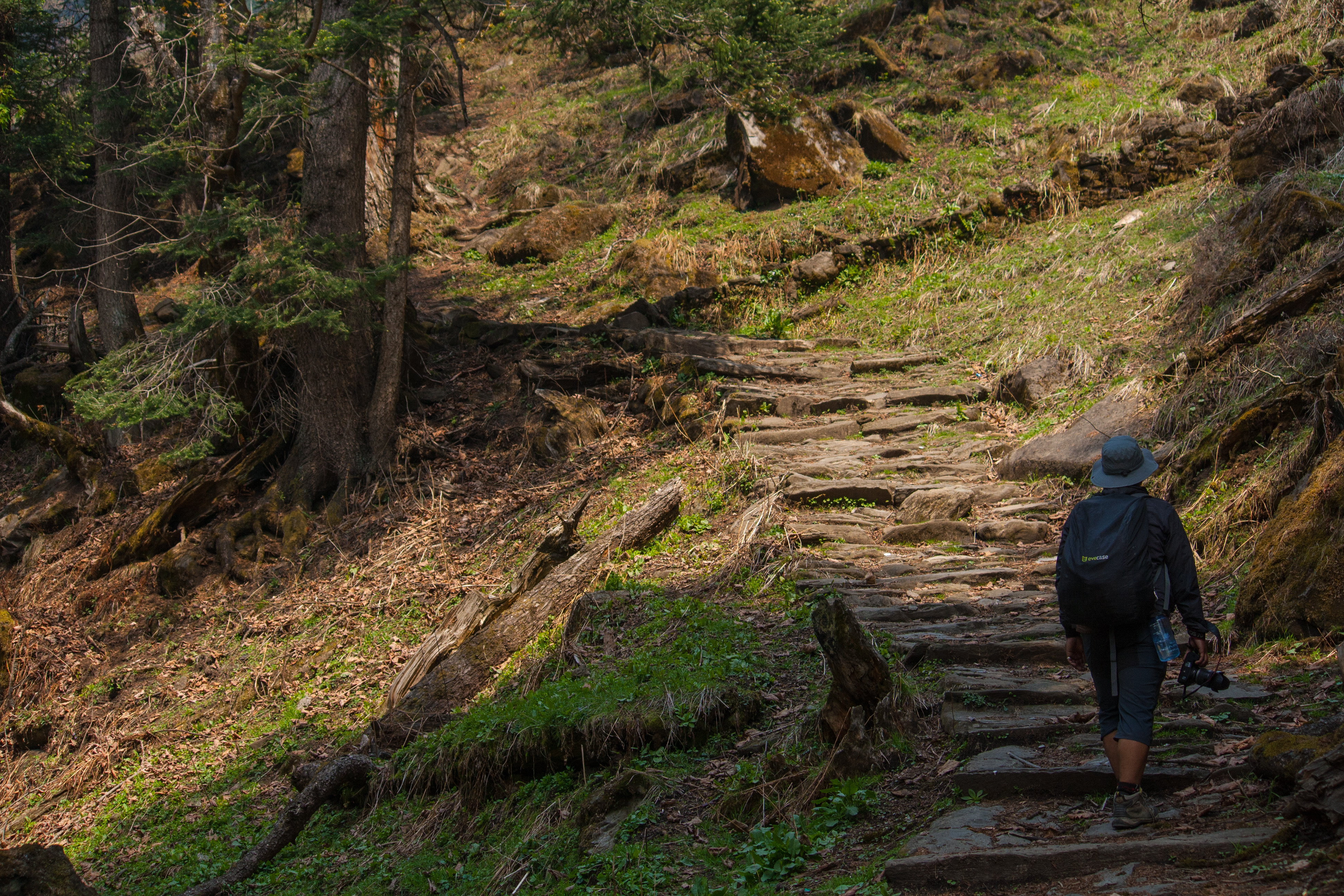
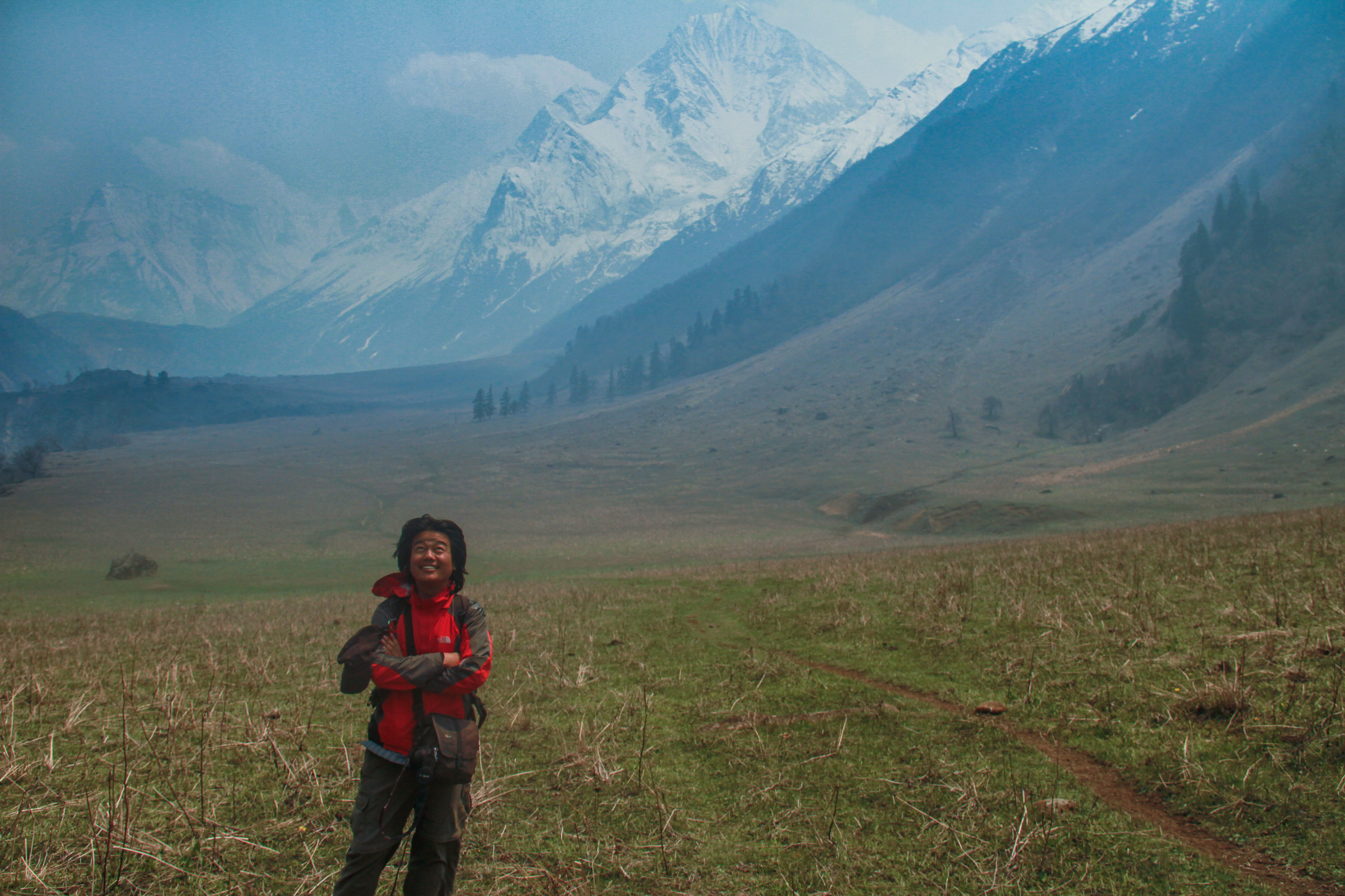
Next day, we reached Changroo. The view was better. We could see waterfalls on the Indian side. After around two hours of walk, we reached Budhi. Budhi was a small stretch of flat land next to Mahakali. Father and son ran a single hotel here. The son had selective hearing. He would answer questions he wanted and acted as if he didn’t hear when he didn’t want to. It took 2 hours for our lunch. But it was sooo good. Local potatoes and Rajama. Now, we would find settlements only at Changroo. There were other hotels in Budhi but they were all closed and would open when Yarsa season was in full swing. We had to climb for about an hour to reach Kontisang. Our first sighting of mountains was here. Conifer forest would envelope us from this way forward till we were near Api river. I soaked my feet in Api river for five seconds. They became numb with cold. Here, the way to Api and the way to Changroo separates. Trek to Api requires at least two days of camping to reach the base camp. Way to Changroo was downhill from this point on. Right before we reached Changroo, the land goes flat. Mahakali had branched out into two. We were a bit confused which side was Nepal at Changroo because we saw beautiful managed hotels. It was Nepal. We stayed at Kailash Hotel run by Jeet Singh Bohora. We knew him from our talk earlier with Prem Uncle.
Changroo is a village full of art. Intricate woodwork will make you wonder how did they have all this time. Villagers had very recently started their migration and we could see only handful of homes were occupied. People here move to Khalanga in winterr and back to their village in summer. People of Tinker hadn’t even started moving. So Changroo would be our last stop. Since we couldn’t go to Tinker, we went to Nampa Chaur. On our way to Nampa, we crossed a snow bridge. It had snowed heavily last year, and the bridge was still intact.
Nampa Chaur literally is sitting on the lap of mountains. But since that year was record year for high number of forest fires, we couldn’t get good view. Still, we could see the mountains and it was breathtaking. I wonder what it would have looked like had there been no forest fires. Primulas were in full bloom. We could see herds of horses and yaks that were semi-wild. We were informed that owners come once in few months to feed them salt.
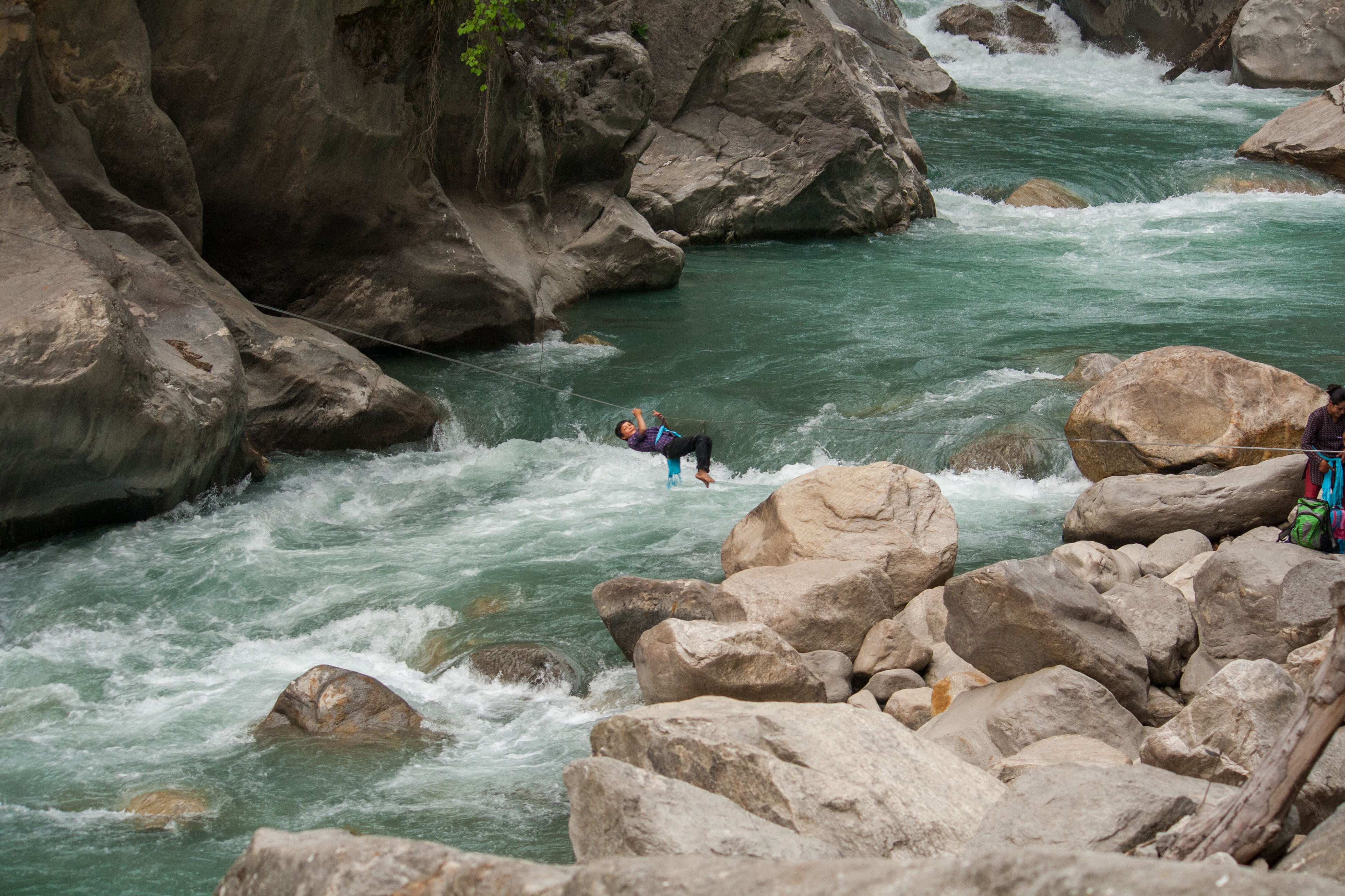
Our return trip was a little different. We stopped at Budhi for the night. Then we crossed Mahakali in Dopakhya on Tuin wires. This was one of the greatest and most pleasant experience of our trip. Not the wires, but the helpful sisters who were so fluent in helping people. They helped us like it was nothing. Even persuading their little brother to carry our bags with a bit of encouragement “tarde na. Dharmai hunxa” (take it across. Its good karma). On the other side of Mahakali, we got on a jeep (again managed by these wonderful sisers) and reached Khalanga. What would have taken us two days, took two hours through Indian side.
Our itinerary (skipping rest days)
Day 1: Kathmandu-Attariya
Day 2: Attariya-Darchula Khalanga
Day 3: Darchula Khalanga-Bangabagad-Shreebagar-Brahmadev-Huti-Dhaulakot-Sunsera
Day 4: Sunsera-Sagran-Fulechungan-Rangthala-Maal Gaun-Dumling
Day 5: Dumling-Dudi Khola-Chattibagar-Dopakhya.
Day 6: Dopakhya-Budhi-Kontisong-Changroo
Day 7: Changroo-Nampa Chaur-Changroo
Day 8: Changroo-Kontisong-Budhi
Day 9: Budhi-Dopakhya-Dumling-Indian side ( 2 hrs jeep ride)- Darchula Khalanga
Day 10: Darchula Khalanga-Attariya
Day 11: Attariya-Kathmandu
Watch the video here.
2 responses to “Darchula Calling”
Just a quick write on my Darchula trip. Hope you like it.
Amazing